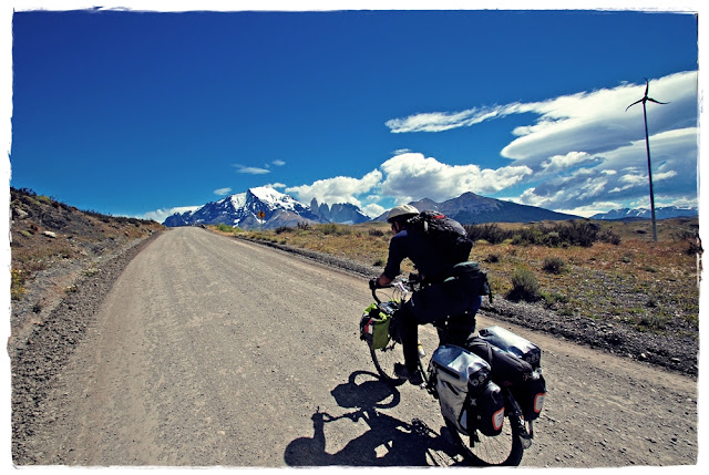
HEADING FOR GLACIER GREY - The next day, we hopped on our steeds to go after Glacier Grey, our main target towards finding and observing field evidence of the effects of Climate Change In Southern Patagonia.
Along this expedition, we are taking daily samples of atmospheric conditions for our partners at the University of Chile, to contribute to their understanding of atmospheric patterns at a local scale. Given its latitudinal extension (spanning 39 latitude degrees) Chile is, per se, a multi-climatic country; from the driest desert on Earth, at the very north end—between the Equator the Tropic of Capricorn—to the extreme precipitation of Patagonia, at the World’s End.
There are very few atmospheric stations in Southern Patagonia, so we take samples of Wind Speed, Wind Direction and Temperature twice a day, at synoptic hours 12 and 18 UTC (Coordinated Universal Time). This information will be used by the Department of Geophysics at the U. of Chile in Santiago, to contrast with their meteorologic computer models.
Synoptic hour: Hour (UTC) determined by international agreement at which meteorological observations are made simultaneously throughout the world. The primary synoptic hours are every six hours, commencing at 00:00 UNC.
Synoptic hour: Hour (UTC) determined by international agreement at which meteorological observations are made simultaneously throughout the world. The primary synoptic hours are every six hours, commencing at 00:00 UNC.
 |
Rod heading for Lake Pehoé, towards Glacier Gray. |
While we are lucky to ride under an incredible sun, we find out that the tales about 80mph wind gusts in
Torres del Paine National Park are totally true... Did you say "Head-Gusts"? Yes, for the next 5K!
Glacier Gray is at the terminus of the Southern Patagonian Ice Fields, the largest non-Antarctic ice fields in the southern hemisphere—the fastest area of glacial retreat on Earth, responsible for nine percent of the total annual global sea-level rise from mountain glaciers between 1975 and 2000, according to the 2001 IPCC Scientific Assessment. From 1995 through 2000, however, the rate of ice loss from the ice fields more than doubled, to an equivalent sea level rise of 0.1millimeters per year (source: NASA + CECS Chile)
Rod spent five years in Torres del Paine National Park, leading visitor groups and exploring trackless routes throughout this rugged topography. His observation leads to confirming Glacier Grey is shrinking at record rates; the rock that is now visible (below) due to the calving process of the Glacier was covered in ice only 5 years ago.
Below is a comparison: the upper pic was taken in 2006. Six years later, the photo we took (lower) shows retraction is evident. While this is exactly the kind of evidence we came to document here, it is an unfortunate finding. Our plan is to return on 2015--human powered again--with this information, in order to contrast with what we will find then.
NASA’s image of June 2007 (above), taken from the International Space Station does not show this rocky formation emerging from the ice tongue of the glacier. It does show that all three lobes have retreated over the 22-year period,
 |
| graphics: Global Nomad |
between '86 and '07, with the greatest loss of ice occurring along the westernmost lobe terminus. Grey Glacier, like others in southern Patagonia, loses ice from its terminus as it enters the water, a process known as calving. Calving produces large free-floating chunks of ice; some floating ice is visible near the central glacier lobe in the upper image. The observed retreat means that ice loss has been greater than ice replenishment. It is most likely due to a combination of increased regional temperatures and changes in precipitation amounts. (source: Earth Observatory, NASA).


No comments:
Post a Comment